Look Out, La Nina may be coming and it's due..
 Below is the response I sent to Jeff Illingsworth, a friend of mine for years from Puerto Vallarta. We have been talking about the possiblity of La Nina coming on , when he sent me this information. For those of you who really keep an eye on conditons, this is worth reading and analyzing since it will affect fishing. How exactly is for speculation, it just depends on how sever or lite La Nina turns out to be, if indeed we do move into a La Nina conditon. Check the links out so you Yellowfin Tuna Guys can make your own determinations…..
Jeff,
Great Info Jeff, I will share it on my blog and in an article or two…. I will also forward the link to the web site you provided so people can look it all up for themselves….
Yes, I believe we are seeing water a little warmer than normal for this time of year and yes, I believe we will see migratory species move up the line a little earlier than normal (we’re already seeing that happen), but there are signs of a weakening El Nino. Keep in mind that this is determined by looking at SSTs along the Equator and not off the SoCal/Baja coast. The push of warmer water that has begun will likely carry us into the summer season. Here is the latest update from the Climate Prediction Center:
A transition to ENSO-neutral conditions is expected by June 2010, which will continue into the Northern Hemisphere summer 2010.
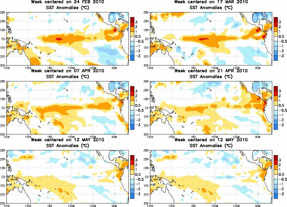
El Niño weakened during April 2010 as positive surface temperature (SST) anomalies decreased across the equatorial Pacific Ocean. However, SST anomalies still exceeded +0.5oC across most of the Pacific at the end of the month. Since the end of February, subsurface heat content anomalies (average temperatures in the upper 300m of the ocean have decreased steadily in association with the expansion and strengthening of below-average temperatures at depth 25-200m. Also, enhanced convection developed over Indonesia, while suppressed convection strengthened and expanded over the tropical Pacific, south of the equator. The low-level equatorial trade winds remained near-average, and anomalous upper-level westerly winds prevailed over the central Pacific during much of April. Collectively, these oceanic and atmospheric anomalies reflect a weakening El Niño.
Nearly all models predict decreasing SST anomalies in the Niño-3.4 region through the Northern Hemisphere summer 2010. Most models predict a transition to ENSO-neutral conditions during April-June 2010, followed by ENSO-neutral conditions through the end of the year. However, by July-September 2010, the envelope of model solutions includes a significant number (nearly a third) indicating the onset of La Niña conditions. Even though ENSO-neutral conditions are most likely during the second half of the year, the general tendency of the models in recent months has been toward increasingly negative SST anomalies in the Niño-3.4 region. These forecasts, in addition to various oceanic and atmospheric indicators, indicate a growing possibility of La Niña developing during the second half of 2010.Inbox?number=2008385880&part=1.2&filename=sstaanim.gif
